PLEASE CLICK ON AN IMAGE TO ENLARGE
Brunswick Heads
Town in New South Wales, Australia / From Wikipedia, the free encyclopedia

Originally inhabited by people of the Bundjalung nation, the Brunswick River was charted by Captain Henry Rous in 1828. His visit was followed more than 20 years later by cedar cutters, whose activities led to the creation of the first town in what is now Byron Shire. By the 1880s, Brunswick Heads was a busy port with a small commercial centre.[citation needed]
The township went into decline after the opening of the Murwillumbah railway line through Mullumbimby in 1894. From the 1920s, however, Brunswick's popularity for family seaside holidays returned. Holiday cottages from that period are still in evidence throughout the town.[citation needed] The early camping grounds along the foreshores later became caravan parks.
Poet and painter Edwin Wilson (1942-2022) started school at Brunswick Heads, as recorded in his 2000 autobiography The Mullumbimby Kid.
Geography
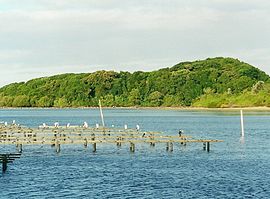
Brunswick Heads is a small coastal holiday village situated at the mouth of the Brunswick River. Torakina Beach is located within the breakwater, while a white sandy surf beach stretches to the south. The north bank of the river is the home to a protected rainforest and the southern bank provides a harbour and small marina for fishing boats and small craft. Mount Chincogan and Mount Warning are located in the area, and form a backdrop to the river that leads down from the small town of Mullumbimby.[citation needed]
Despite the surrounding coastal development, Brunswick Heads has retained its traditional seaside village atmosphere.[citation needed] Timber bridges link the riverside to the river and surf beaches.
Brunswick Heads is situated 10 km (15 minutes drive) north of the town of Byron Bay and 30 minutes travelling time from both Coolangatta and Ballina airports, and 40 kilometres south of the Queensland border. Brunswick Heads is across the river from Ocean Shores. The Pacific Highway bypassed Brunswick Heads in 1998.
Economy
Brunswick Heads has a number of cafes, restaurants, accommodation and specialty shops.[citation needed] Brunswick Heads offers a range of leisure activities all year round, and hosts a number of small-scale community and family-oriented festivals and events.
In popular culture
The town was the location for the cult 1980s comedy series Brunswick Heads Revisited (a send-up of Waugh's Brideshead Revisited), broadcast across Australia by the ABC. The fourth series of the ABC TV drama series, SeaChange, was filmed there in 2019.
Brunswick River course and features
Brunswick River rises on the eastern slopes of Mount Jerusalem, at Palmwoods, near Uki, and flows generally east southeast, before reaching its mouth at the Coral Sea of the South Pacific Ocean, at Brunswick Heads. The river descends 142 metres (466 ft) over its 34 kilometres (21 mi) course; through the towns of Mullumbimby and Brunswick Heads.
Brunswick River is impounded by a lake at Tyagarah, where the local tea trees give the lake water a brown tint. This lake becomes a popular swimming hole in the summer months and is used by naturists who come down from Tyagrah Beach. The naturist area is only about 15 kilometres (9.3 mi) north of Byron Bay.
The north arm of the river, called Marshalls Creek, flows through Ocean Shores, Billinudgel, Ocean Shores North and The Pocket. Marshalls Creek also connects to a canal in Ocean Shores North and South Golden Beach. The south arm of the river, called Simpsons Creek, flows through Brunswick Heads, Bayside and Tyagarah.
Between Brunswick Heads and Ocean Shores, the Pacific Highway crosses the river.
The northern bank at the mouth of the river is the northern extent of the Cape Byron Marine Park.


No comments:
Post a Comment